-
Main Corporate Website
-
XPS
-
Glencore Technology
-
Zipatank
-
Hypersparge
-
IsaKidd
-
IsaMill
-
IsaSmelt
-
JamesonCell
-
Albion Process
-
Viterra
-
Aquarius Energy
-
Glencore in South Africa
-
Glencore in the DRC
-
Mutanda Mining
-
Kamoto Copper Company
-
Astron Energy
-
Katanga Mining Limited
-
Glencore Australia
-
Viterra Australia
-
Bulga Coal
-
Liddell Coal
-
Mangoola
-
McArthur River Mine
-
Mt Owen Complex
-
Ravensworth operations
-
Ulan Coal
-
United Project
-
Wandoan Coal
-
West Wallsend
-
Murrin Murrin
-
Mount Isa Mines
-
Main MenuWho we are
-
Main MenuWhat we do
-
Main MenuOur assets
-
Our assetsCCR
-
CCRWho we are
-
CCRWhat we do
-
CCRSustainability
-
CCRCareers
-
Contact us
-
-
Our assetsEVR
-
Our assetsGeneral Smelting of Canada
-
General Smelting of CanadaWho we are
-
What we do -
General Smelting of CanadaSustainability
-
Industry Associations and References -
Contact us
-
-
Our assetsHorne Smelter
-
Horne SmelterWho we are
-
Horne SmelterWhat we do
-
Horne SmelterOur projects and innovations
-
Horne SmelterSustainability
-
SustainabilityEnvironment
-
SustainabilityCommunity
-
Health and Safety -
Our certifications -
Our awards -
Visit the Horne Smelter
-
-
Horne SmelterCareers
-
Horne SmelterNews & media
-
Contact us
-
-
Our assetsKidd Operations
-
Kidd OperationsAbout us
-
Kidd OperationsSustainability
-
Contact us
-
-
Our assetsRaglan Mine
-
Raglan MineWho we are
-
Raglan MineWhat we do
-
Raglan MineSustainability
-
Raglan MineCareers
-
Raglan MineInsights
-
Contact us
-
-
Our assetsSudbury INO
-
Sudbury INOWho we are
-
Sudbury INOWhat we do
-
Sudbury INOSustainability
-
Health -
Safety -
SustainabilityEnvironment
-
Community
-
-
Sudbury INOInnovation and technology
-
Sudbury INOCareers
-
Sudbury INOMedia
-
Contact us
-
-
Our assetsLegacy assets
-
Legacy assetsBrenda Mine
-
Legacy assetsBrunswick Smelter
-
Legacy assetsMatagami Mine
-
-
-
Main MenuSustainability
-
Main MenuMedia
-
Main MenuCareers
-
Contact us
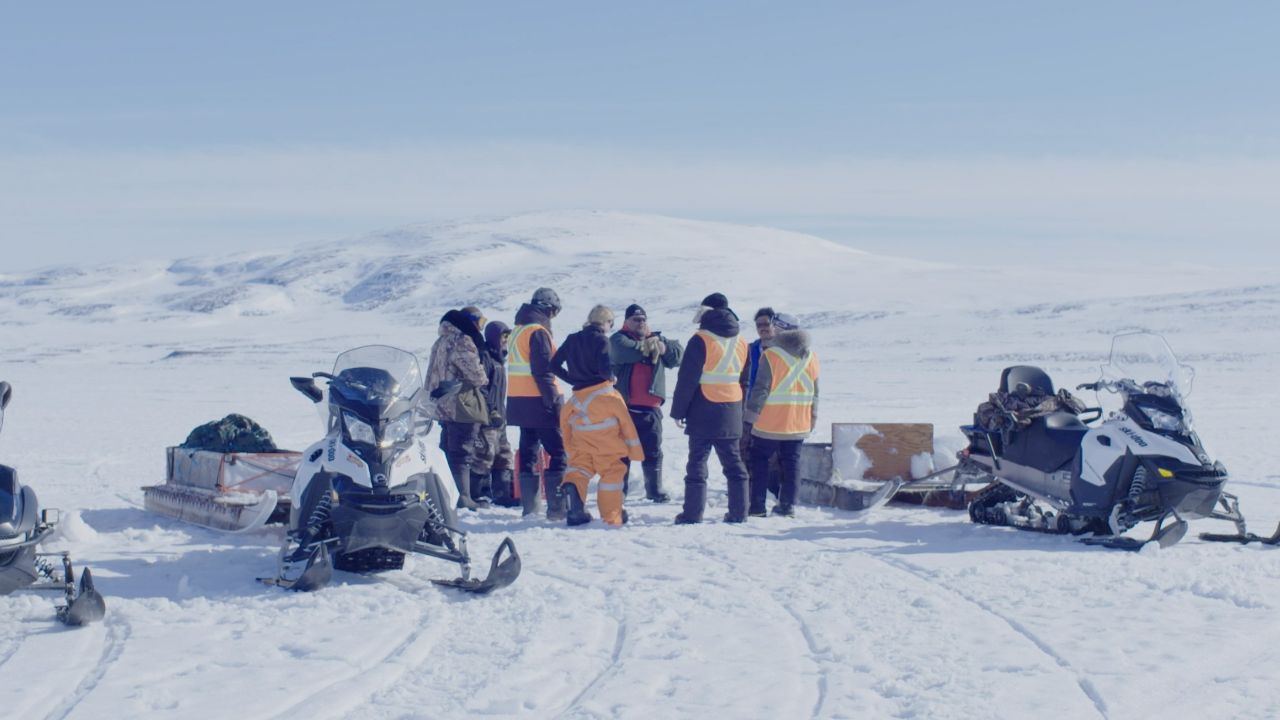
We have launched a new ice monitoring project as part of ongoing efforts at Raglan Mine to improve environmental practices and remain a pioneer in sustainable development.
Climate change has created more dangerous sea ice conditions, so we are working together with local communities and governments to make ice expeditions safer. Climate change complicates ice thickness measurements, with potentially perilous results. We also hope this project will prove beneficial for our Inuit partners.
Cameras have been installed in seven Nunavik communities by the Kativik Regional Government (KRG), Institut national de la recherche scientifique (INRS) and Ministère des Transports, Mobilité durable et Électrification des transports du Québec (MTMDET). Every hour, these cameras send images to caiman.ete.inrs.ca via satellite so it can be determined whether it's safe to travel on the ice. Ice thickness is measured twice a year at Deception Bay, Kangiqsujuaq, and Salluit.
Local communities, industry representatives and researchers all utilize this website. It is designed to provide continually updated information that's easy to interpret and use. You can see images from these cameras here: Cameras at Marine Infrastructure in Nunavik (CAIMAN).
Explore this project: watch these videos in French and English.
*Please note that this video (long version) is only available in English.
-
TeaserWatch FilmTeaser
-
Long VersionWatch FilmLong Version
Photo of a satellite camera.